Ordnance Survey Plans (OLD)
Site Location & Site Plans
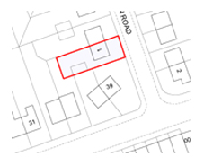
We are able to provide Site Location Plans & Site Plans needed for a Planning Application, Right’s of way access and Property Sales on a property. These can be to a scale of your choice but for Local Authorities They should be at a scale of 1:1250 & 1:500. These plans show the local Authorities where your property is located how your property sits on the land and the boundary line around your land.
- Electronic format OS Plans from £20 (Depending on area needed) can be sent to you in AutoCAD or a PDF file to a scale of your choice.
- A3 Prints required for a Planning Application from £25 for up to 10 sheets of A3,
- Plans up to A0 are available in both colour and Black & White contact us for more information
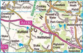
Current Mapping
We are also able to provide Plans / Maps showing a larger area of land such as whole Towns & Cities these are ideal for Surveying and hobbies such as Rambling, Cycling and Orienteering.
Maps can be printed in a choice of scales and can of the following format
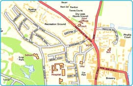
Street maps – Shows Street level detail, Building outlines, Street names,
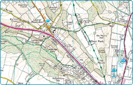
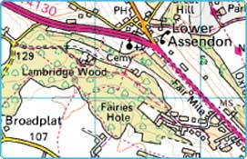
Explorer – Shows height of Contours, rights of way, field boundaries, recreational path routes,
Town maps – Shows all roads & Buildings as blocks of colour
Road Atlas – Combines roads, Railways, Cities and Towns,
Contact us for more information & prices on Current Mapping.
Design & Access Statements
Local Planning from time to time require Design & Access Statements for projects to enable them to understand about your current and Proposed Building and the changes it will have on the surrounding area. Let us prepare these for you